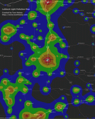
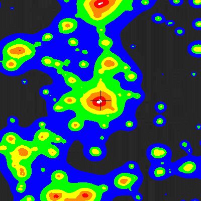
I created these maps by merging a Map Point map with the light
pollution image found at the Clear Sky Clock.
I got the idea for this map from this
page, which is the originator of the scale that accompanies
the CSC map. Thanks to the angle of
the orbital images, the
light pollution image is not strictly to scale, but rather is
compressed in height or width. So you need to stretch and
adjust the image to match the map. The merging isn't too difficult, if
you're familiar with Photoshop, but the adjustments in size or
scale can be tedious.
So what does all this mean? If you can see the street lamp
from orbit or an airplane, this is light that serves no useful
purpose and wastes light. These maps show direct light
visible from orbit and are a measure of wasted energy in our
urban environment.
Where does this light originate? Any light that's visible
from a airplane or from orbit is wasted. The primary
source of this light is the security and street lighting
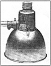
fixtures with large glass globes:
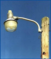
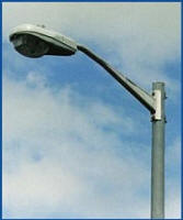
Images from Choptank Electric http://www.choptankelectric.com/meminfo/lighting.html
The light that goes upward or excessively outward is not useful
and is simply wasted. Worse, it can actually decrease the
usefulness of the light by increasing the glare in the area.
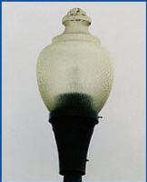
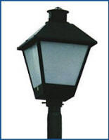
The two most common lamps can be greatly improved with the
addition of inexpensive reflector-shields:
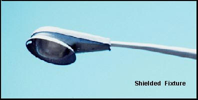
Not only will these shields prevent light pollution, but they
can also give significant energy savings. Accorded to
common statistics, the bad fixtures waste 30% or more of the
produced light. These shields would allow the owner to use
a lower wattage lamp that would use less power to produce the
same amount of light.


